 |
AGE GeoGlobe
Fact Sheet (pdf) |
AGE's GeoGlobe is a 3D based visualization and dissemination tool designed to make the discovery and exploitation of geospatial information more intuitive and productive within the DOD user community. AGC's GeoGlobe is based on Skyline Software's SkylineGlobe suite of products. This enterprise software allows users to access AGC's geospatial data archives and products through a locally installed 3D client for Internet Explorer and Internet Information Services (IIS).
|
 |
AGC Imagery Office
Fact Sheet (pdf) | Imagery Repository
The AGC Imagery Office (AIO) functions as the U.S. Army's commercial imagery acquisition agent and monitor. This action is designed to prevent Army agencies and organizations from duplicating imagery acquisition/data purchases. The AIO is also designated as the repository of selected commercial satellite/aerial imagery and AGI data pertaining to terrain analysis and water resources operations. The AIO repository is accessible to DoD users via an online search & discovery application requiring user registration.
|
 |
Buckeye
Fact Sheet (pdf) | Product Catalog
The BuckEye mission is to rapidly collect, process and distribute Unclassified high resolution and high accuracy color imagery and elevation data. BuckEye collected over 85,000 square kilometers in Iraq, and has collected over 160,000 square kilometers in Afghanistan. There are several fixed winged and unmanned systems currently operating in Afghanistan. BuckEye's requirements and tasking are controlled at the International Security Assistance Force (ISAF) level. A majority of the imagery and LIDAR is processed in-theater to provide rapid tactical response.
|
 |
Common Map Background
Fact Sheet (pdf) | Product Catalog
CMB provides digital map and image data to the Warfighter. CMB utilizes a comprehensive digital data library and custom ArcGIS toolset designed to dramatically reduce the time and expense required to acquire, manage and distribute geospatial.
|
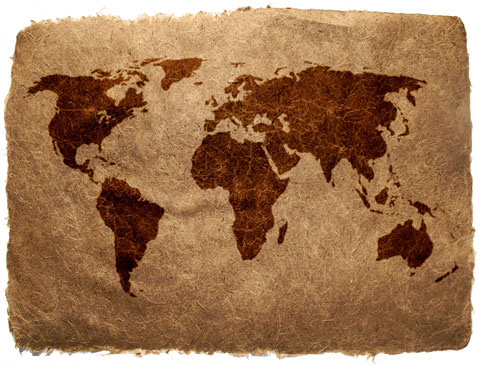 |
Cultural Mapping
Fact Sheet (pdf) | Product Catalog
The CMAP is a geodatabase collection of digitized, geo-referenced, and categorized cultural information. This product was created using the ESRI ArcGIS mapping software. The National Geospatial-Intelligence Agency World Country Boundary data is used to geo-reference the source maps. The data sources include open-source digital and paper map products, geo-spatial maps, vector data, and geographic subject-matter experts.
|
 |
Engineering Route Studies
Fact Sheet (pdf) | Product Catalog
The Engineering Route Study is designed to provide basic information on the major surface transportation systems in conjunction with terrain and climate data. The ERS is intended to provide data at the country or operational level to assist the warfighter in planning a variety of missions including military operations, humanitarian relief, transportation studies, and drug enforcement.
|
 |
Fly-Thrus
Product Catalog
AGC produces assorted terrain fly-thrus using TerraExplorer software. Fly-thrus are designed to provide terrain visualization and can be accessed on the Fly Thru Product Library page.
|
 |
Geospatial PDF Maps
Fact Sheet (pdf) | | |
The Army AGC Geospatial PDF program is tasked with producing Geospatial PDF versions of all AGC products and has created the Country Geospatial PDF DVD (a disk or set of disks containing all NGA standard maps for a given country).
|
 |
Geospatial Information Library
|
The Geospatial Information Library focuses on physical geography, terrain analysis and military hydrology, and provides support to all authorized Army, DoD, and other government organizations.
|
 |
Ground Truth 360
Fact Sheet (pdf) |
Geospatial Intelligence Video (GIV) is full motion, high-resolution, interactive spherical video technology. The camera system utilizes eleven video streams arranged according to geodesic geometry to capture an almost complete spherical image.
|
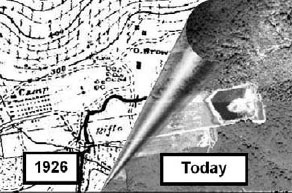 |
Historical Photo Analysis
Fact Sheet (pdf) | Product Catalog
Historical Photographic Analyses (HPA) is used by analysts to address environmental concerns related to land use change, such as historical wetland evaluation, shoreline change, watershed/land use mapping and produces a variety of baseline environmental analyses.
|
 |
LIDAR
|
Light Detection and Ranging (LIDAR) sensors provide high resolution and high accuracy 3D geospatial data. It can be used by U.S. Forces in Iraq for improved situational awareness, battlefield visualization, mission planning, and force protection.
|
 |
Manual of Environmental Effects
|
The Manual of Environmental Effects (MEE) contains vast amounts of information on areas of interest to the Department of Defense. Each country this product was developed for contains information on on the following envrionmental aspects: topography, geology, natural resources, soils, vegetation, wildlife, climate, temperature, precipitation, humidity, cloudiness, aircraft icing, visibility, surface winds, thunderstorms, and special phenomena.
|
 |
Military Capabilities Studies
|
The MCS is a Department of Defense program designed to provide a compendium of intelligence data on the military, economic, political and environmental resources of a country. MCSs are intended to serve as a ready reference document for national, operational and tactical planners.
|
 |
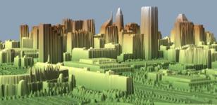
Modeling and Simulation
M&S Terrain Generation - VBS/2 | Dynamic Synthetic Environments |
Modeling and Simulation Terrain Databases that have been previously generated at the Army Geospatial Center are available at no cost to DOD and DOD contractors. M&S databases available for reuse can be found at the Defense Modeling and Simulation Office’s Master Environmental Library (MEL).
|
 |
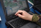
OHASIS
OHASIS is an enterprise GIS focused towards the non-GIS expert for entering critical humanitarian-related data to be used by the GIS analyst. This system is designed to be flexible and part of the larger Humanitarian Enterprise, not the one solution for all humanitarian assistance organizations. Built upon ESRI’s ArcGIS Server Enterprise capability, OHASIS supports connected clients via web browsers, disconnected and causally connected clients using laptop and portable computing devices, database synchronization and replication between server nodes deployed in key areas, and advanced GIS analysis.
OHASIS is comprised of three modules to include Humanitarian Assistance Management, Excess Property Warehouse Inventory management, and the Denton and Funded Transportation program management.
|
 |
Urban Tactical Planner
|
The Urban Tactical Planner, or UTP assists the planning and visualization of military operations in the world's urban areas. The urban environment is displayed as an aggregate of features that affect urban area operations, such as building form and function (broken out as polygons of like-building types), building height, vertical obstructions, terrain feature, bridges, lines of communication, key cultural features, landmarks, etc. These features are shown as themes or layers that can be displayed, on-or-off, as decided by the user.
|