 |
Historical Photo Analysis
Fact Sheet (pdf)
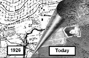
Historical Photographic Analyses (HPA) is used by analysts to address environmental concerns related to land use change, such as historical wetland evaluation, shoreline change, watershed/land use mapping and produces a variety of baseline environmental analyses.
|
|

|
National Inventory of Dams
Fact Sheet (pdf) | Brochure
The website enables query of dams using any of the 60+ fields of information, including dam name, height, type, purpose, year of construction, and owner, with query results shown on screen. Users can also display and query dams using the interactive map and show relevant features, such as state, county, congressional boundaries, waterways, and major cities. To query the database, users must request an account from the NID Login tab. After a short approval process, users will receive an email notification with username and password. There is a short PowerPoint tutorial available from the Interactive Report as well as other help documentation on the Interactive Map function.
|