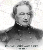
Colonel John James Abert, 1788-1863
The 71st graduate of West Point, as a civilian employee of the War Department, he volunteered as a private for the defense of Washington, DC, and was later brevetted Major, Staff Topographical Engineers, after the Battle of Bladensburg, Maryland, August 24, 1814. During the years between 1816 and 1827, Major Abert made surveys of the Atlantic Coast and America's inland frontier. In 1829, he was appointed to the position of Chief of the Topographic Bureau, and ten years later in 1838, he was promoted to Colonel and Commandant of the new Corps of Topographical Engineers. This new Corps of Engineers had charge of the surveys of canals, roads, the Great Lakes, rivers and harbors. He was the founder and head of this Corps for some thirty-two years.
Upon his death, the US War Department made this statment of his contributions:
"The Army and this country will not need to be reminded of the vast interest and value attached to the operations of this Corps since its organization. The geographical and other information concerning this continent which its officers have collected and published has challenged the admiration of the scientific world, while the practical benefit of their labors has been felt in nearly every state and in every Territory; the whole being a pround monument to him who was its founder."
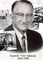
Talbert "TED" Abrams, 1895-1990
Ted Abrams was an inventor, an explorer and an aviator as well as a business executive. His pilot's license was signed by Orvill Wright after he first soloed in 1918, when he was an officer of the US Marine Corps Aviation Section. After World War I, he formed the Abrams Aerial Survey Corporation, where he became a pioneer in aerial surveying and in aerial mapping. He developed the first airplane, the Model P-1 "Explorer",designed exclusively for photography, and the Explorer was later used by the military during WWII for aerial mapping and reconnaissance. Ted Abrams also invented a number of mapping instruments and camera enhancements to aid the military efforts in war and civilian efforts in peace.
Ted Abrams' contributions to remote sensing, topography and cartography include his many inventions such as the Explorer airplane, his camera enhancements and precision instrumentation manufacturing accomplishments, and his many contributions to aerial mapping during and after World War II.
Ted Abrams once noted that during the course of his career, he had mapped by air 1,720 American cities, 515 counties, 5,800 miles of highways, 48,000 miles of utility lines, and more than 1,000 major mapping and aerial photography projects in 96 counties.
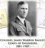
Colonel James Warren Bagley, 1881-1947
Major James W. Bagley was an employee of the US Geological Survey when called into service for World War I. Bagley brought his recently invented tri-lens camera to France, where it was used to make one vertical and two oblique images from airplanes. Major Bagley made a successful trial flight in December 1917 using the three-lens camera. It is said that this event marks the actual beginning of aerial surveying in the United States.
This images were used to overprint enemy trenches and gun emplacements over existing maps for precision targeting. After the war, he was in charge of an Engineer unit at Wright Field, Ohio, to further develop aerial photography military applications, and to produce a nucleus of expert photogrammetrists.
During this time, Major Bagley invented a five lens camera, the model T-3A, which could be used by topographers who already knew the distance between any two points, to then compute the remaining measurements and prepare a two-dimensional or planimetric map. This camera saw extensive use during World War II.
The use of the T-3A cameras, when mounted side by side, produced a field of about 400 square miles. From the provisional maps prepared from the planimetric maps, multiplex operators determined elevations and filled in contours by stereocomparagraph. This technique allowed an Army topographic battalion to product contour maps of over 100 square miles a day, a vital improvement in marking and targeting the modern battlefield.
He was commander of the 29th Engineer Base Topographic Battalion from 1928 until his retirement in 1936. In 1937, Colonel Bagley became a lecturer at Harvard Unversity, and wrote several articles and a book, "Aerophotography and Aerosurveying."

William Clark, 1770-1838
The famous co-commander of the Lewis and Clark team during the US Army Corps of Discovery mission of 1804-1806, William Clark was a noted explorer, mapmaker and topographer. In 1791, he joined th regular army in the West, and lived for four years in the field in Ohio and Indiana, where he learned military command, engineering and topography. After resigning his commission in 1799 and returning home, Thomas Jefferson offered him a place on the expedition to explore the Northwestern American Continent over the Rocky Mountains, and to discover, if possible, a water route to the Pacific Ocean.
While most Americans recognize William Clark's achievements in mapping the northwest, he is perhaps best known for his diplomacy in Native American affairs. He was able to persuade the Sioux and other tribes to remain either neutral or to side with the Americans against Britain in the War of 1812, and thus probably saved the Upper Mississippi Valley and territories for the US. William Clark is also famous for negotiating a treaty of peace between the Sioux and Chippewa tribes by mapping an established boundary between their two tribes. This treaty, attended by over a thounsand chiefs, was negotiated at Prairie Du Chien, Wisconsin, in 1825, and ended almost a century of warfare between these two powerful tribes, their allies, and the smaller tribes caught between them.
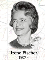
Irene Fischer, 1907-
At the very beginning of her career in mathematics and geodesy, Fischer had quickly taught herself the basics of geodetic tables, datums, transformations, gravity studies, astronomy, long lines, flare triangulation, and guided missiles. Her updates to geodetic science helped determine the parallax of the moon. Fischer was also intrigued by research into post glacial uplift, and her geoid studies went hand in hand with investigations of the lingering effects of the last ice age.
Dr. Fischer disagreed with the established figure for the oblateness of the earth (the fraction by which the polar axis is foreshortened by the equatorial radius), which had remained unchallenged since 1924. She was forbidden to use her updated figures in her own work because that result was in disagreement with the accepted literature. However, after the flight of the first satellites, she was vindicated by the data and observations, and she was allowed to amend her previous works with her newly derived figure. In commenting on the lack of faith others put on her research, Fischer goodheartedly quipped that the satellites had not accepted the accepted literature, either.
A pioneer during the time when there were few women in surveying, in 1967, Dr. Fischer was the first AMS employee, and only the third woman ever to receive the Distinguished Civilian Service Award. Dr. Fischer was internationally known for her many publications and presentations on the size and shape of the earth, including the DOD manual, "Latitude Functions Fischer 1960 Ellipsoid." In addition, Dr. Fischer has written more than 120 other reports, articles and books in her fields of expertise, and many of her significant government reports are still classified today.

William Helmsley Emory, 1811-1887
William Helmsley Emory was noted for mapping the United States border, including the Texas-Mexican border, the United States-Canadian border and the Gadsden Purchase. He was born in Queen Anne's Country, Maryland and attended the United States Military Academy, graduating in 1831. Assigned as a 2nd Lieutenant, he served in the 4th Artillery until he resigned from the service in 1836 to pursue civil engineering, but he returned to the service in 1838, when he was given the rank of first lieutenant in the newly created Corps of Topographic Engineers. In 1838, when the Corps of Topographic Engineers was authorized, it consisted of thirty-six officers, one of which was Emory. It was during the second stint in the Army when Emory mapped the United States borders.
From 1839 to 1842, Emory, who had become an expert on harbor improvements, worked on a project along the Mississippi River, a task he found well-suited to his engineering interests. Then in 1843, he was elevated to the post of assistant in the Topographical Bureau in Washington, where he remained until 1844. In 1844, Emory served in an expedition that produced a new map of Texan claims westward to the Rio Grande River. He came to public attention as the auther of the Notes of a Military Reconnaissance from Fort Leavenworth in Missouri in San Diegok California, published by the Thirtieth United States Congress in 1848. This report described terrain and rivers, cities and forts and made observations about Indians, Mexicans, primarily in New Mexico Territory, Arizona Territory and Southern California. It was and is considered one of the important chronicles and descriptions of the historic Southwest, particularly noted for its maps.
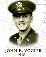
John R. Vogler, 1916-
In 1942, as Chief of the Engineer Research Office (ERO), Capt. John R. Vogler was tasked to supply requested military geology and geographical information to the Corps of Engineers Intelligence Branch about selected overseas sites. He combined the disparate efforts of civil and topographic engineers, geologist, librarians, translators and cartographers into a disciplined assembly line system. He accomplished his goals by dividing the work into research; library bibliography; translation and writing; the color reproduction of maps; and the final editing, printing and distribution of the maps and reports. This work process was unprecedented, and at full capacity, Captain Vogler's team in the ERO worked on 16 assignments simultaneously, completing one publication each week and having the others in various stages of progress within the assembly lines.
In June 1943, the ERO submitted a four volume report on French inland waterways, which was published as the first of over eighty "Strategic Engineering Studies" in the European Theatre of Operations. Other reports in this series included terrain analysis, water and soil studies, and topographical and geological maps of China, many Pacific Islands and the Japanese home islands.
After an urgent request for traffic control and target selection data, the ERO produced a four volume study of 364 Italian bridges, taken mostly from pre-war Italian engineering publications, and by December 1943 had printed another ten volumes data on Italian railroad bridges and tunnels.
After completing his work with the Engineer Research Office at the end of World War II, Captain John Vogler continued his work with the intelligence community. From 1963 to 1976, he worked for the DIS, and from 1972 to 1976, he served as an Assistant Deputy Director of the Defense Intelligence Agency.

George Montague Wheeler, 1842-1905
Wheeler was a pioneering explorer, cartographer and leader of the Wheeler Survey, one of the major surveys of the western United States in the late nineteenth century. He graduated from West Point in 1866, ranked sixth in his class, and was commissioned as a Lieutenant in the US Army Corps of Engineers. Wheeler's first exploration occurred in 1869 while on the staff of the Commanding General of the Department of California of the US Army.
In 1872, the U.S. Congress authorized an ambitious plan to map the previously unmapped portion of the United States west of the 100th meridian at a scale of 8 miles to the inch. These surveys, which operated under a general plan issued by the U.S. Army Corps of Engineers, were put under the supervision of First Lieutenant George M. Wheeler. According to the general plan, Wheeler's main objective was to servey the parts of the U.S. territory lying south of the Central Pacific Railroad in order to obtain correct topographical knowledge and prepare maps of the region. In addition, he was to ascertain everything related to the physical features of the region; discover the numbers, habits, and disposition of Indians in the section; select sites for future military installations; determine facilities available for making rail or common roads; and note mineral resources, climate, geology, vegetation, water sources, and agricultural potential.
The total area covered by all survey expeditions was 1,443,360 square miles in the states of what are now New Mexico, California, Nevada, Arizona, Utah, Colorado, Idaho, Oregon, Wyoming, and Texas. As a result, the survey produced 95 rectangular sheets, each comprising 2º 45' of longitude and 1º 40' of latitude, at a uniform scale of eight miles to one inch. Over the course of eight seasons (1871-1878), the survey managed to map approximately one-quarter of the projected total.
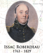
Issac Roberdeau, 1763-1829
Lieutenant Colonel Isaac Roberdeau was a civil and military engineer remembered for assisting Pierre Charles L'Enfant in laying out the city of Washington. He was born in September 1763 in Philadelphia and was the son of Daniel Roberdeau, a revolutionary war general. Following his work with L'Enfant, he surveyed for canals in Pennsylvania, Delaware, and New Jersey. In 1813, he was appointed a major of Topographical Engineers. In 1815, he co-le a team that surveyed the boundary between the U.S. and Canada lying between Whitehall, NY and Niagara Falls. In 1816, he was commissioned a major in the Army's revived Topographical Corps of Engineers and in 1818 was appointed th first chief of the Topgraphical Bureau of the War Department headquartered in Washington. He was brevetted and lieutenant colonel in 1823.
Under Roberdeau, the Topgraphical Corps of Engineers became a clearing house for accurate geographical information for the entire country. Among its notable acts was involvement in the sea coast survey originally proposed by Thomas Jefferson in 1807 and officially launched in 1816. To complement this effort, Roberdeau proposed the establishment of a notional observatory to insure the accuracy of the survey.
His other acts and accomplishments included producing an illustrated essay on canal design and construction; assisting astronomer William Lambert in calculating the longitude and latitude of the Capitol; conducting a survey of the city of Annapolis, Maryland; delivering an oration upon George Washington's death in 1800; and serving under Secretary of War John C. Calhoun where he was put in charge of caring for the government's surveying and weighing instruments as part of the Topographical Bureau's missions.
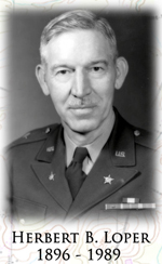
Herbert B. Loper, 1896-1989
General Herbert B. Loper was responsible for the coordination of photographic and mapping activities of the military and naval forces in the Pacific and served in Washington DC in the intelligence section of the Office of the Engineers during WW II. After the War, he served as chief of the joint photo and survey section of the Joint Chiefs of Staff, Joint Intelligence Group.
Loper was born in Kansas on 22 October 1896, graduated from the United States Military Academy in 1918 as a 2nd lieutenant, and was commissioned in the Corps of Engineers. In World War II, he was in an engineering intelligence unit and later helped plan operations for the Marianas and Okinawa campaigns. He retired from active duty in 1953 after serving with the Joint Chiefs of Staff. From 1954 to 1961, he was Chairman of the Military Liaison Committee.
He held many engineering positions within the US and at the Panama Canal Zone. He graduated from the Command and General Staff College at Fort Leavenworth in 1940. He later went to the Pacific, where he planned engineering operations for the Marianas and Okinawa campaigns, as well as the development of Army bases in those areas for subsequent operations against Japan. In 1945, Loper was assigned the additional duty as Chief of Engineer Intelligence Division for the Southwest Pacific areas.
His later responsibilities included chief of the Armed Forces Special Weapons Project. He also served on the Military Liaison Committee to the Atomic Energy Commission and later chairman of the Committee.

Charles H. Ruth, 1889-1949
Captain Charles H. Ruth was first commanding officer of the Army Engineer Reproduction Plant (ERP), the forerunner to the Army Map Service (AMS), the Army Topographic Command (USATC), the Defense Mapping Agency (DMA), the National Imagery and Mapping Agency (NIMA), and the current National Geospatial-Intelligence Agency (NGA).
Before 1917, topographic mapping was largely a function of individual field engineer units using field surveying techniques or copying existing or captured products. Reproduction was primarily accomplished by the Department of Interior or commercial facilities. There was little concern or interest in the United States for maps of foreign countries or regions.
In 1917, America entered into World War I as a major ally in Europe. The ERP was the Army Corps of Engineers' first attempt to centralize mapping production, printing and distribution. During the course of the conflict, the ERP produced some nine million maps. Later, in 1939, the ERP assumed the "supervision and maintenance" responsibility of the War Department Map Collection.
It was due to Captain Ruth's initial direction that the ERP and its descendent agencies became one of the major military topographic organizations in the world. Captain Ruth left the Army in 1919 and joined the Evening Star newspaper staff in Washington DC, working there for thirty years. In 1942, the ERP was moved from Fort McNair in Washington DC to Brookmont, Maryland where it transitioned into the AMS. Charles Ruth died in 1949 and in 1953, the Army Map Service Building #1 in Brookmont was formally dedicated as the Ruth Building in his honor.

Donald Jenks Belcher, 1911-2005
Dr. Donald J. Belcher, the foremost pioneer in the field of remote sensing, established his reputation at Purdue University by establishing and directing the engineering department's experimental research station's airphoto laboratory in 1939. He later joined Cornell University's School of Civil and Environmental Engineering in 1946 where he founded and then directed the Center for Aerial Photographic Studies until he retired in 1976.
Belcher earned his academic degrees at Purdue University establishing the airphoto laboratory to support studies of the inspection of the Indiana highway system and site location studies for the Civil Aeronautics Administration. With his first PhD advisee, Robert E. Frost, they conceived the idea of air photo interpretation through pattern analysis to support military terrain analysis and submitted their idea to the two war theater staffs. The query to the European Theater received no response. However, after a successful demonstration of their idea to General MacArthur's staff, Belcher became a civilian consultant who worked to improve the military's intelligence of battlefield conditions, especially landing beaches for the Pacific Theater campaign. Later, using his skills in interpreting aerial photographs, he helped locate landmines in Western Europe and consulted with U.S. military and civilian agencies and foreign governments.
He located the site for Brasilia, Brazil's modern capital city, and identified the unique terrain appropriate for the world's largest radio telescope at Arecibo, Puerto Rico (still administered for the NSF by Cornell). He helped interpret surface conditions on Mars and the moon, and his computer-based system for land use and natural resource inventories was adopted by New York State, Puerto Rico, South Africa, Australia, and Venezuela. Belcher's interest in highway safety continued through his career with the publication of numerous reports for the Highway Research Board, all involving the use of aerial photography for analysis, investigation and interpretation but confirmation through ground checks. Through his studies and teaching, many of his students have become prominent in the field of remotely sensed imagery.

Gilbert W. Kirby, 1925-
Brigadier General Gilbert W. Kirby is referred to as "The Father of Computer Science at West Point." Under his visionary leadership, the importance and application of computers to both the academic interests of the Academy and the "outreach" to the Army were set in motion.
He served in combat duty as a Marine during World War II in the South Pacific and later graduated from the United States Military Academy (USMA) and commissioned into the U.S. Army Corps of Engineers. He was one of the youngest tactical officers at the Engineer Officer Candidate School at Fort Belvoir.
In 1960, he joined the Department of Military Topography and Graphics at West Point where he served as a key member of the faculty. In 1976, his outreach to the Army resulted in the creation of the Academy center known as the Computer Graphic Laboratory in which a small group of faculty and cadets provided enormous value to the active forces through the use of computer analysis of terrain data. TERRABASE, an integrated software package, created by the laboratory, allowed field commanders to view battlefield terrain in terms of mobility and counter-mobility. The software was employed by all corps and division terrain teams of the active force as well as many reserve component units. The Office of Artificial Intelligence Analysis and Evaluation was established by him in 1986 to provide further outreach support to the Army.
In addition to guiding the USMA into the computer age, Brigadier General Kirby shifted the nature of courses in his department to keep pace with exploding technology. New electives in physical geography, astronomy, environmental studies, world and regional geography, automated cartography and geographic information systems were introduced. The department also began teaching terrain analysis to provide future Army leaders an integrated understanding of cartography, remote sensing, and the earth sciences. He also directed the research and completion of many remarkable USMA publications including The Atlas of Landforms, The Landscape Atlas of the USSR, and a Bibliography of Military Geography.
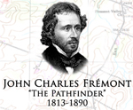
John Charles Fremont, 1813-1890
The magnetic and legendary "Pathfinder" became a national hero early in life for his trailblazing exploits in the Far West. A leader in wresting California from Mexico, he served as one of the stat's first senators and got rich in the Gold Rush.
John Charles Fremont was born in Charleston, SC January 1813. After attending the College of Charleston, Fremont was appointed a teacher of mathematics aboard the sloop USS Natchez. In July of 1838, he was commissioned as a 2nd Lieutenant in the Corps of Topographical Engineers. During 1838-1839, he was Joseph Nicollet's assistant in the two expeditions exploring the lands between the Mississippi and Missouri Rivers; and in 1841, with training from Nicollet, he mapped portions of the Des Moines River.
Wanting to explore the Rockies, Fremont obtained government backing and in 1842, started on a series of explorations throughout the western U.S., the Rockies, and terriroty not yet part of the U.S. He explored the South Pass, along the route that would become the Oregon Trail. Fremont's reports of his explorations included not only the geography and layout of the land, but also included descriptions of strategic locations, botanical notes, and geological observations. Congress and the public enthusiastically read his accounts, and Congress ordered the printing of thousands of copies of Fremont's reports. His expeditions continued, taking him through thousands of miles of the country's wilderness. He traveled the mountains, valleys, and rivers of the largely uncharted West, through Oregon, California, Utah, and New Mexico. He documented some of the least-known places in the West, like the Great Salt Lakes and Alta California and its basin. He met with explorers, soldiers, presidents, and Indians. He knew the likes of Kit Carson. He led his expeditions through the Rockies, and into the Sierra Nevada range. Fremont was promoted to captain in 1844. As the Mexican War loomed on the horizon, Captain Fremont led a regiment into California.
In 1845, Fremont rallied the settlers in California to stand up against Mexican rule. Rebellious settlers gathered on June 14, 1846 in the plaza of Sonoma, California and forced the Mexican Colonel Vallejo to surrender. This resistance was the beginning of an independent California republic and is sometimes called the Bear Flag Revolt. Subsequently President Polk exhorted Fremont to guard and defend the interests of the United States against foreign agents that might act to impede the possible annexation of California by the United States in the event of war with Mexico.
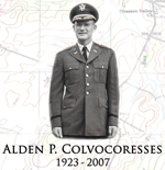
Alden P. Colvocoresses, 1923-2007
Dr. Alden P. Colvocoresses developed the first satellite map of the U.S. He was born in Arizona and served in the U.S. Army during World War II, the Korean War and the Vietnam War. He was a member of the U.S. Army Corps of Engineers from 1941 to 1968.
During World War II, he oversaw the photo mapping process in preparation for the D-Day assault on Normandy. For his military service he was awarded two Purple Hearts, two Silver Stars with Oak Leaf Clusters, and a Bronze Star.
Dr. Colvocoresses received a degree in mining engineering from University of Arizona, a M.S. in geology and a PhD in geodetic sciences from Ohio State University. After his military service, as a research cartographer for the U.S. Geological Survey, he researched and pioneered the use of space based remote sensing to identify and map submerged obstrucitons. In the 1973-1979 time frame, he developed the Space Oblique Mercator projection to map images from Landsat satellites with which he later used to develop the first satellite map of the United States.
He received two patents for his work in mapping and the Interior Department's Distinguished Service Award. He served as president of the American Society of Photogrammetry and Remote Sensing (ASPRS) in 1988 and five times received the ASPRS Presidential Citation for Meritorious Services. Dr. Colvocoresses discovered a reef in the Indian Ocean that was subsequently name for him.
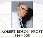
Robert Edson Frost, 1916-2001
Robert E. Frost was a pioneer in interdisciplinary imagery analysis for engineering, military and scientific purposes and the co-originator in concept and use of coordinated aerial survey/ground survey procedures.
Frost completed all of his advanced education at Purdue University, where in 1946, he took over the airphoto laboratory from his graduate advisor, Donald Belcher. Together they conceived the idea of air photo interpretation through pattern analysis to support military terrain analysis. When Belcher left to support General Douglas MacArthur's staff, Frost planned for airfield studies on the Alaskan North Slope. With an increase in Purdue's airphoto consulting work, Frost became instrumental in the formation of the Snow, Ice and Permafrost Research Establishment (SIPRE), one of the two forerunner agencies to the Cold Regions Research and Engineering Laboratory. In the early 1970's, he along with seven personnel from his division (Photographic Interpretation Research Division) were transferred to the Engineer Topographic Laboratories. In 1974, his division became the Center for Remote Sensing.
Frost applied aerial photo analysis and interpretation techniques to the Arctic regions doing pioneering work for airfield siting on the Alaskan North Slope, siting eight of the Distant Early Warning (DEW) Line Sites (1954-1958), and locating construction materials for permafrost airfield construction in Thule Air Base, Greenland. His 1950 Corps of Engineers two volume report "Evaluation of Soils and Permafrost Conditions in The Territory of Alaska by Means of Aerial Photographs" is one of the landmark studies on the subject. His report included not just artic conditions but analogous landform types in other climate regions.
From 1956 to 1985, Frost directed and participated in more thatn 20 research projects from Sensing of Cold Surfaces and Crevasse Detection in Greenland to mobility engineering research studies in thailand to impact of herbicide defoliants in Viet Nam to the Fort Dix "Man in the Pinelands" joint interagency environmental study. Frost served as an expert witness for the Corps of Engineers on eight major lawsuits involving Federal water resources projects.
Through these numerous projects, before retiring in 1990, Frost had "trained" through 86 short courses - affectionately known to most of his students as "The Frost Course" - well over 2,000 people from all walks of life and educational backgrounds to be stereo air photo analysts and interpreters.

Stephen Harriman Long, 1784-1864
Colonel Stephen H. Long was an explorer engineer, inventor, and military officer. He led expeditions through the American West in areas acquired in the Louisiana Purchase following the Lewis and Clark Expedition. He explored an area covering 26,000 square miles in five expeditions. Colonel Long served as the last Chief of the Topographical Engineers from 1861 and 1863.
Stephen Harriman Long was born in New Hampshire and graduated from Dartmouth College in 1809. As a member of the U.S. Army, he served as professor of mathematics at the U.S. Military Academy. As an Army officer, he led a pioneering scientific expedition throughout a large area of the Great Plains, which he famously described as the "Great American Desert." He conducted extensive explorations and surveys in the Northwest and Rocky Mountains for the specific purpose of finding the sources of the Platte, Arkansas, and Red Rivers. As a member of the US Topographical Engineers, he led several expeditions into the United States borderlands with Canada including the Upper Mississippi Valley, the Red River of the North and across the southern part of Canada. He worked with Zebulon Pike in the Rocky Mountains and Long's Park, the highest summit in the Rocky Mountains, in named after him. He served for many years as chief engineer for improvement of western rivers. He fixed the northern boundary at the 49th parallel in 1823 and was the chief surveyor for most of the railroads in the western U.S. His maps proved invaluable to the union Army during the Civil War.
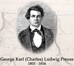
George Karl (Charles) Ludwig Preuss, 1803-1954
Charles Preuss was John C. Fremont's cartographer. Preuss was born in Hohsheid (prussia, now Germany) in 1803. After studying the science of geodesy, he became a surveyor for the Prussian government. In the United States, he worked for the first superintendent of the United States Coast Survey, Ferdinand Hassler, who advised Fremont to look over some of Pruess's maps. Fremont, then a young 2nd, lieutenant, was duly impressed with what he saw and offered Preuss the job of completing the map of the Mississippi basin which included computing latitudes and longitudes from astronomical observations.
In 1842, Fremont and Preuss went to St. Louis together, the start of what was to be a long and fruitful relationship. In St. Louis, they prepared for an expedition to map the Pacific Northwest. Preuss was 39 by this time, red-faced and ill-humored. The two were a badly matched pair, but Preuss played perfect counterpoint to Fremont. If Fremont saw the poetry in the unfolding landscapes around him, Preuss saw precise longitudes and latitudes.
Preuss proved to be an important member of Fremont's expeditions of 1843-44 and 1848 as well. He drew daily maps of all routes which later proved invaluable. The Fremont/Preuss maps of this period were the basis for all western maps of the following two decades. One author writing on the mapping of the Tran Mississippi West said, "The 1845, Fremont/Preuss map changed the entired picture of the West, and made a lasting contribution to cartography." Another author indicated that the Fremont/Preuss map," was the first of a series of scientific mapping of the western country and a landmark in the progress of geographical knowledge."
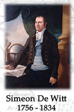
Simeon De Witt, 1756-1834
Simeon De Witt is noted successor to Robert Erskine as George Washington's "Geographer and Surveyor of the Army" and as "Surveyor General of New York State."
Born in 1756, De Witt was in 1776 the lone graduate of Queens (Rutgers) College in New Brunswick, New Jersey. Fleeing British capture, he joined the Revolutionary Army in New York City, and in 1778, was appointed assistant to Colonel Robert Erskine due to his early training as a surveyor. When Erskine became ill and subsequently died in October 1780, De Witt was then named as Geographer and Surveyor of the Army in December 1780, holding that position through the war's end. The Erskine-De Witt team produced nearly 300 known maps and sketches during the Revolutionary War.
After the war, in the expanding development of the "Empire State" of New York, De Witt continued prolifically producing maps as the Surveyor General of New York State, a position held until his death in 1834. His office surveyed, approved, and filed literally hundreds of land documents. He is credited with the founding of Ithaca, New York, where he was originally buried when he died at a residence there.
Among his maps of note are a map of Long Island, New York, the first of some accuracy since the British occupation and a 1790 map of Albany, New York, which featured a projected street grid that provided a guide for future development beyond the old river town area for over a century.
He was very interested in arts and sciences and was among the founders of the "Society for the Promotion of Agriculture, Arts, and Manufactures." Later, he was vice-president and then, from 1813 to 1823, president of the organization that later became the Albany Institute of History and Art. He served on the New York State Board of Regents and was named chancellor of the University of the State of New York in 1829. He also was a member of the American Philosophical Society, among many other organizations. A devoted member of the Dutch Reformed Church in Albany, he was one of a number of member of the Dutch Reformed Church in Albany, he was one of a number of members who in the early 1800's freed their slaves.
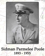
Sidman Parmelee Poole, 1893-1955
To Sidman P. Poole is attributed the establishment of geography as a significant tool in the formulation of military plans. In a 1944, in a paper entitled "Training of Military Geographers" he encouraged and promoted the Army's use of geographers and their broad knowledge of the physical environment "in defense of their country." The result was a substantial and continuing interest in geographic research and applications by each branch of the U.S. Armed Forces as well as the civilian intelligence agencies.
Colonel Poole was born in Syracuse, New York and served on the faculties of Syracuse University and the University of Virginia as professor of Geography. After World War II, he established the Department of Geography at the University of Virginia where he was the Chairman of the School of Geography. He was a member of the U.S. military in both World War I and World War II and won the American Legion of Merit and the Honorary Commander of the Order of the British Empire for his contribution in World War II. From 1940 to 1946, Colonel Poole served as Chief of the Topographic Bureau of the War Department where he mobilized geographers for war service. Among his war time achievements was the key role he played in successfully identifying a specific area in Japan as the point of origin for balloons used to start fires in the American Pacific Northwest in 1944.

Andrew Atkinson Humphreys, 1810-1883
General Humphreys was notable as a topographic engineer, Civil War general and commander, and Chief of Engineers.
Born in Philadelphia, Humphreys was the son and grandson of chiefs of naval construction. His grandfather, under President Washington, designed the first warships for the U.S. Navy including Old Ironsides. Humphreys graduated from the Military Academy in 1831 and served as an artillery officer in Florida during the Seminole War.
He resigned from the Army due to poor health in 1836 but later accepted an appointment as a first lieutenant in the new Corps of Topographical Engineers in 1838, supervising primarily harbor works over the ensuing years. In 1843, he designed and planned the first expansion of the U.S. Capitol building. In 1850 he led a survey of the Mississippi River Delta but was again forced to other duties due to illness, during which time he traveled in Europe making notes on river and harbor improvements. In 1854-61, he headed the Office of Pacific Railroad Explorations and Surveys. His co-written, with Henry L. Abbot, "Report Upon the Physics and Hydraulics of the Mississippi River" was translated into several languages. The report became a 19th centry classic in hydraulic literature, and in its thoroughness and accuracy provided the Corps of Engineers approach to flood control until the massive 1927 flooding.
Humphreys rose to major general during the Civil War distinguishing himself on the battlefield as one of the more agressive commanders at Fredericksburg and Gettysburg. He served as General Meade's chief of staff but returned to command the II Corps in late 1864 to Lee's surrender at Appomattox. In 1866 he became Chief of Engineers until retiring in 1879. It was under his guidance that the Atlas to the Official Record of the Civil War was prepared. He established the Engineer School of Application and oversaw a substantial expansion of the Corps' river and harbor work.
Humphreys held a Harvard degree, published Civil War histories, and was one of the "original fifty corporators" of the National Academy of Sciences. He died December 27, 1883, in Washington, D.C.
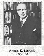
Armin K. Lobeck, 1886-1958
Lobeck had an influential career as an illustrator, geology teacher and geographer. He studied architecture and botany but earned his PhD in 1917 in geology. Lobeck was one of the acknowledged experts in the field of drawing block diagrams, once a useful and evocative way of representing terrain.
In addition to a distinguished teaching career at both the University of Wisconsin and Columbia University, he served both the State and War Department as a geographer and an illustrator during both world wars. He worked as a cartographer in Paris during the American Commission to Negotiate Peace in 1919 during the Treaty of Versailles.
Lobeck's maps were extremely detailed and large scale sheets were often five feet by five with a vertical exaggeration of four times. The border between Guatemala and Honduras was depicted no less that two fett long for example.
As one geographer noted,'Armin Lobeck was a gifted cartographic illustrator. He understood the land surface as well as anyone in his era, he knew how to draw and interpret maps, and he mastered the concise integration of maps, block diagrams, and written text.'
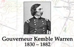
Gouverneur Kemble Warren, 1830-1882
General G.K. Warren is primarily known as a Civil War general for the union army, distinguishing himself by "saving the Union" during the battle of Gettysburg at Little Round Top. A West Point graduate of 1850, second in his class, Warren had written to his father in 1851 that "I would rather rough it than be sent there before hard service had me above reproach." It was rumored he was to stay at West Point as a mathematics instructor.
Warren was brevetted a second lieutenant in the Corps of Topographical Engineers with a first assignment as assistant to Captain A.A. Humphreys on the survey of the Mississippi Delta. He was then assigned to the War Department to compile under a Congressional mandate a comprehensive map of the west as explorers returned with information on possible routes for the first trans-Mississippi railroad. A military operation to settle Native American unrest provided the opportunity for him to see the lands that he was compiling from others' reports. To fill the necessary detail he conducted three reconnaissances to the Nebraska and Dakota territories between 1855 and 1858. He observed the tactical use of terrain as he conducted explorations and had along civilian scientiests such as V.F. Hayden on his exploration of the Black Hills. However, while planning his fourth expedition to the northern great plains and west, his fater died, and he took an assignment to West Point to be close to his family. Had he conducted this fourth expedition, discovery and exploration of the Yellowstone area would have been added to his list of impressive accomplishments.
During the Civil War, he received a commission as a Lieutenant Colonel of Volunteers in the 5th New York Infantry Reginment, rising to serve as Chief Topographical Engineer and then Chief Engineer, Army of the Potomac. After Gettysburg, he commanded the 2d Corps until March, 1864, when Grant made him 5th Corps commander, which he led into the Petersburg trenches a year later in April, 1965. Although Warren was successful against the Confederates, Sheridan thought he did not press the attack fast enough and relieved him "for cause."
Following the Civil War, he reverted to major and returned to the Mississippi Valley, again connected with railroading, as the first "Engineer in Charge" of the St. Paul office. He assumed construction of the first bridge across the Mississippi River at Rock Island, Illinois. Assessing the plans, Warren redrew them as a double-deck with train way on top, wagon way underneath so as not to spook the horses. He incorporated a swing-span to allow passage of boat traffic through the weir. Although the bridge has since been twice replaced, the double-deck concept and the actual swing-span works are still in operation today near the original bridge site. An ever delayed board of inquiry finally exonerated Warren of any neglect at Five Forks. However, it was too late as he had died three months earlier in August, 1882. At his request his family buried him in civilian clothes and without military ceremony at Newport, Rhode Island. Starting in 1969, the National Academy of Sciences awards a prize in his name every four years for distinguished contribution to fluviatile morphology and closely related aspects of the geological sciences.

Colonel Robert Erskine, 1735-1780
Geographer and Surveyor General of the Continental Army
Born in Scotland and a graduate of the University of Edinburgh, Erskine was interested in what is now known as hydraulics, and invented several pumps and a centrifugal hydraulic engine. For this and other accomplishments, Robert Erskine was made a Fellow of the Royal Society in 1771. Asked to take charge of an iron works near Ringwood, New Jersey, he became impressed with the American Revolutionary cause, and formed a militia unit that made him captain. Asked to help with the defense of the Hudson River, Erskine developed some fortifications and some tetrahedron shaped marine "cheveaux de frise" barriers that prevented British ships from sailing up the river. General Washington was so impressed by this feat and other military accomplishments, that he appointed Erskine as Surveyor General. Even after his appointment, Erskine managed and maintained the ironworks to supply needed munitions and materials to the army.
As Geographer and Surveyor General of the Continental Army, Robert Erskine drew upwards of 275 maps covering the northern sector of the war. His maps of the region, showing roads, buildings, and other details, were of much use to General George Washington and still remain historically valuable to scholars. Many scientists today also credit Robert Erskine for founding the field of hydraulics.
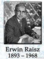
Erwin Raisz, 1893-1968
Erwin Raisz was an internationally renowned cartographer who is best known for his pioneering work in landform mapping and for perfecting the physiographic map. His minutely detailed, hand drawn, pen and ink maps, which were based on field observations and aerial photography, presented a real portrait of the face of the earth. His achievements in landform rendering as well as his cartographic instruction at the Institute of Geographical Exploration at Harvard University, shaped the mapmaking field of the early to mid 20th Century to an unmistakable degree.
Born in Hungary, he was the son of a civil engineer and was introduced to maps at a young age. From there his interest grew and he devoted his life to studying maps, geography and cartography. In 1923, he immigrated to the United States with a degree in civil engineering and architecture from Royal Polytechnicum in Budapest and attended Columbia University graduate school. Eventually he found a place a Harvard University where he taught cartography and was curator of the Map Collection for almost 20 years from 1931.
Raisz's landform maps straddle the line between information design and pure art, and it isn't hard to see why. Landforms graduate from mere symbols to three-dimensional forms which are so solid one almost wants to reach out and touch the mountains, valleys, rivers, hills and plains. Equipped with an excellent memory and relentless output, he redefined what the printed map can represent. His famous landform maps of countries and continents made nearby lands familiar and distant lands real places one could actually picture themselves walking about in, rather than mere concepts.
Erwin Raisz significantly helped to shape the field of cartography in the United States. He authored the first cartography textbook in English, General Cartography in 1938. He was appointed the first map supplement Editor of the "Annals of the Association of American Geographers." His papers were read before meetings of the members of the Association of American Geographers, the American Congress on Surveying and Mapping and the International Geographical Congress. At the time of his death, he was assisting in the compilation of the "National Atlas of the United States." He perfected block-pile maps, introduced value-by-area-cartograms, created the orthoapsidal projection, but is best known for his landform maps.
"Earth Scientists generally agree that the hand-drawn landform maps of Erwin Raisz are classics of the cartographer's art. His large 1939 (revised for the sixth and last time in 1957) map of the old 48 United States, in particular, must rank as a national treasure. There really are no other maps quite like these, and I dare say there will never again be anything else like them." Richard J. Pike, U.S. Geological Survey, Menlo Park, CA
"I have long been fond of telling students that Raisz's landform map is the best map of the U.S. that I know of, irrespective of subject. No matter how one sets about to judge a map - as cartography, as art, or as a vivid and accurate rendition of the American land - the map is incomparable. I have traveled with it for more than thirty years; indeed, to travel by air in the U.S. without Raisz is (to me) unthinkable." Peirce Lewis, Professor of Geography, The Pennsylvania State University, University Park, PA
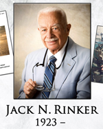
Jack N. Rinker, 1923-
Dr. Rinker conducted exploratory and basic research in remote sensing and associated technologies for over 40 years of federal service. He served as subject matter expert for remote sensing, spectral sensing, and terrain analysis science and technology programs.
After World War II service in the U.S. Navy, Dr. Rinker completed his education at Purdue University completing a Ph.D. in Bacteriology in 1957. He joined the Photo Interpretation Research Branch of the U.S. Army Snow, Ice and Permafrost Research Establishment where he developed remote sensing and image analysis techniques for military and civil applications. He went on to conduct research and development on a wide range of remote sensing technologies (photo, infrared thermal, radar, multispectral, hyper-spectral) and to teach these subjects to Army and Air Force teams in the U.S. as well as to government and academic personnel in Latin America. Through this remote sensing research, Dr. Rinker made substantial contributions to the national defense by studying and working in arctic, tropical and desert environments.
He led two international expeditions on the Greenland icecap. As Chief of the Training and Assistance Branch of U.S. Geological Survey, Earth Resources Observation and Science Data Center (1976-1977), he developed and taught short courses in remote sensing for the international community. He came to the Engineer Topographic Laboratories (former name of the Topographic Engineer Center) in 1977 to serve as Team Leader of the Remote Sensing group that by 1992 had expanded into the Center for Remote Sensing within the Research Institute. He formed the interagency Desert Processes Working Group that focused on developing, inproving and documenting the analysis of image patterns for desert terrain. During Operations Desert Shield and Desert Storm working at the Engineer Topographic Laboratories, at Fort Bragg and then in theater, he completed image analyses of seven areas for predicting terrain characteristics in support of cross-country movement. The Remote Sensing Field Guide - Desert produced by the interagency working group became a key asset in support of Operations Desert Shield/Desert Storm and was mandatory reading for every Marine deployed to the operational Middle Eastern theater. Dr. Rinker's knowledge of the desert and his terrain analysis skills were invaluable to warfighters in planning mobility routes, hazards avoidance, defilades positions, and potential ambush sites. His analysis led to the field commander's ultimate decision to use the "left-hook" maneuver, which resulted in a strategic surprise and rapid defeat of Iraqi forces in Desert Storm. Continuing work, he brought to publication the Remote Sensing Field Guide - Desert as an interactive on-line guide to provide the widest possible dissemination to the knowledge distilled in it. Well over a decade later, this interactive on-line guide remains the authoritative source on desert terrain published by the Topographic Engineering Center.
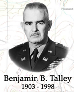
Benjamin B. Talley, 1903-1998
Brigadier General Benjamin B. Talley was a military engineer who became a living Alaskan legend. In a career that spanned nearly half a century his many achievements included readying Alaska for defense from Japanese invasion in World War II. Towards this end he commanded Alaska military wartime construction of Elmendorf Air Force Base in 1940 and Yakutat Airfield. He also established bases at Cold Bay, Adak, Attu, and Shemya Island. After the "Good Friday" earthqueake of 1964 he oversaw and was instrumental in the reconstruction of Anchorage and south-central Alaska.
Aside from his Alaskan exploits, he played an important oversight role in planning for the Omaha Beach landing as Deputy Chief of Staff for Plans for V Corps in 1943. For his leadership and bravery under fire on D-Day and during the period immediately following the landings, Talley was awarded the Distinguished Service Cross.
Born in rural Greer County in western Oklanhoma, General Talley attended both the Georgia School of Technology and the Westinghouse Company Graduate Engineering School, in Pittsburgh, Pennsylvania, receiving both his BS and MS degrees in electrical engineering.
Talley became a commissioned officer in the U.S. Army Corps of Engineers and attended the Engineer School at Fort Belvoir, Virginia. His successes in both military construction and military operational planning in Alaska and elsewhere were due in large part to his early training in mapping and photogrammetry at the Engineer School. His stint as an engineer officer with the 29th Engineer Battalion beginning in 1929, which included participation in the Nicaragua Canal Survey, further served to refine and sharpen his photogrammetric and mapping skills. It was at this time that he invented and patented a portable stereocomparagraph. General Talley also lectured at Harvard University and wrote a textbook on aerial photogrammetry.